Bangladesh digital survey, digital survey services, 4D drone survey, land mapping Bangladesh, aerial survey technology, drone mapping services, real-time land data, precision mapping solutions, drone surveying company, land survey innovation, Bangladesh land surveyors
Digital Survey Solutions in Bangladesh

Elevate Your Land Surveys: 4D Drone Technology Revolutionizing Land Mapping in Bangladesh
Experience the future of land surveys with our advanced 4D drone technology. Gain precise, real-time insights for accurate land mapping and efficient decision-making in Bangladesh.
Others services
Accurate Land Mapping: Utilize cutting-edge technology for precise land mapping services across Bangladesh's diverse terrain.
Boundary Identification: Clearly delineate property boundaries to prevent disputes and ensure legal compliance.
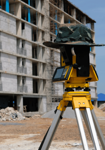
Topographical Surveys: Comprehensive surveys capturing land contours, elevations, and natural features essential for construction planning and infrastructure development.
Cadastral Mapping: Detailed cadastral surveys for land registration, taxation, and land management purposes, promoting transparency and efficiency.
GIS Integration: Integrate Geographic Information System (GIS) data to enhance land management and decision-making processes.
Digital Documentation: Digitize survey records for easy access, storage, and retrieval, streamlining administrative processes.

Remote Sensing Technology: Employ remote sensing techniques for efficient data collection, particularly in remote or inaccessible areas.
Environmental Impact Assessment: Conduct surveys to assess environmental impacts and ensure sustainable land use practices.
Urban Planning Support: Provide crucial data for urban planning initiatives, including infrastructure development and city expansion projects.
Expert Consultation: Access expert guidance and consultation throughout the survey process, ensuring adherence to industry standards and best practices.